Greater North Sea, incl. the Kattegat and the English Channel
Type of resources
Topics
INSPIRE themes
Keywords
Contact for the resource
Provided by
Years
Formats
Representation types
-

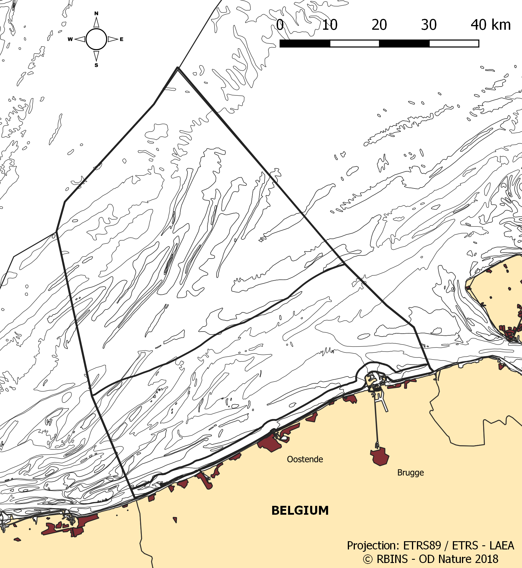
The dataset contains the borders of the Belgian marine waters in the North Sea and the different geographical areas (‘reporting units’) used when reporting in the frame of the the Marine Strategy Framework Directive 2008/56/EC (MSFD) and the Water Framework directive 2000/60/EC (WFD). The ecological status in the frame of WFD is reported for the coastal waters, defined as the one-nautical mile area, while the chemical status needs to be reported for the territorial waters (up to 12 nautical miles). MSFD requires information for the whole area, encompassing the territorial waters and the Belgian Exclusive Economic Zone. For some descriptors, results have been reported separately for the WFD subdivisions during the update of the initial assessment in 2018.
-

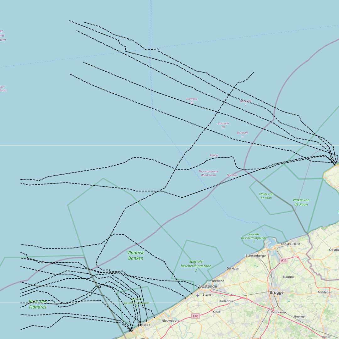
This dataset represents the exact location of disused telecommunication cables installed in the Belgian Part of the North Sea.
-

This dataset is part of the 2018 Belgian submission for the Marine Strategy Framework Directive (MSFD) linked to descriptor 8, criterion 4. This dataset contains measurements on the 7-Ethoxyresorufin-O-deethylase (EROD) activity in Limanda limanda, Imposex (OTIN in Mytilus edulis), fish diseases and counts of oiled common guillemots in the Belgian part of the North Sea.
-

This dataset is part of the 2018 Belgian submission for the Marine Strategy Framework Directive (MSFD) linked to descriptor 6, criterion 5. It comprises three datasets used to assess the sea floor integrity for ensuring a proper functioning of the ecosystem.The dataset on the study of the fauna associated with cobble fields (hard substrates) describes the gravel analysis performed in the Belgian part of the North Sea between 2015 and 2017. Information on the location, date and procedure used for the sediment sampling is provided as well as the description of species found in the samples.The occurrence of important benthic species. The status of benthic habitats (soft substrates).
-

This dataset is part of the 2018 Belgian submission for the Marine Strategy Framework Directive (MSFD) linked to descriptor 8, criterion 3. This dataset gives an overview of the observed slicks during aerial survey operations of the Belgian part of the North Sea (2011-2016). Related to significant acute pollution, it includes the observations linked to the Flinterstar incident in 2015. Besides this, all observations of illegal discharges of MARPOL (International Convention for the Prevention of Pollution from Ships) annex I and II substances are included as an additional dataset.
-

This dataset is part of the 2018 Belgian submission for the Marine Strategy Framework Directive (MSFD) linked to descriptor 4, criterion 2. Three distinct datasets are published for this criterion.'Occurrence of breeding seabirds' describes the observation of eight seabird species (Common tern, Black-headed Gull, Herring Gull, Common Gull, Small Black-backed Gull, Yellow-legged gull, Big Stern and Little Stern) on the Belgian coast between 1992 and 2015. 'Density of seabirds' describes the density of seabirds (N birds/km) observed at large in the Belgian part of the North Sea between 1987 and 2016 (three surveys a year). Thirteen species are monitored and the evolution of each species density is shown as diagrams.'Occurrence of important benthic species' describes the results of Van Veen sampling campaigns performed between 2009 and 2014 in the Belgian part of the North Sea. Benthic species are counted and identified (e.g. Annelida, Echinodermata,..).
-

This dataset is part of the 2018 Belgian submission for the Marine Strategy Framework Directive (MSFD) linked to descriptor 8, criterion 2. This dataset contains measurements on the 7-Ethoxyresorufin-O-deethylase (EROD) activity in Limanda limanda, Imposex (OTIN in Mytilus edulis), fish diseases and counts of oiled common guillemots in the Belgian part of the North Sea.
-

This dataset is part of the 2018 Belgian submission for the Marine Strategy Framework Directive (MSFD) linked to descriptor 5, criterion 2. This dataset contains the average of the 90th percentile chlorophyll a concentration during the growing season (march-october) in the Belgian part of the North Sea for the years 2011-2016. Chlorophyll a concentration (Chl) was generated from satellite daily data from ocean colour sensors. Data is supplied at approximately 1 km resolution on a geographical grid with equal spacing in longitude and latitude covering the described region.
-

This dataset is part of the 2018 Belgian submission for the Marine Strategy Framework Directive (MSFD) linked to descriptor 1, criterion 2. The Raja clavata dataset describes the results of the Offshore Beam Trawl Surveys (BTS) in the Belgian part of the North Sea (BPNS) between 2010 and 2017. Occurrences of Raja Clavata, along with dates and locations, are reported. The codes used in the attached file are based on the ICES DATRAS (Database of Trawl Surveys) standard. The seabirds dataset describes the density of seabirds (N birds/km) observed in the BPNS between 1987 and 2016 (three surveys a year).
-

This dataset is part of the 2018 Belgian submission for the Marine Strategy Framework Directive (MSFD) linked to descriptor 1, criterion 1. Stranded porpoises often show traces of incidental catch in fishing nets (bycatch), a major cause of death for this cetacean in the North Sea. Based on the number of stranded animals showing traces of bycatch, it can be estimated that up to a few dozen porpoises are caught per year. For extrapolation of bycatch data to effects at population level, reference is made to (future) initiatives at regional level.
 geo.be Metadata Catalog